The Aerial View Your Project Needs, Without the Drone
An aerial image should do more than show a project from above. It should reveal how the architecture belongs to its surroundings and why the location matters. Even without a drone flight, Arqing can build the exact altitude, angle, light, weather, and stage of completion your project needs.
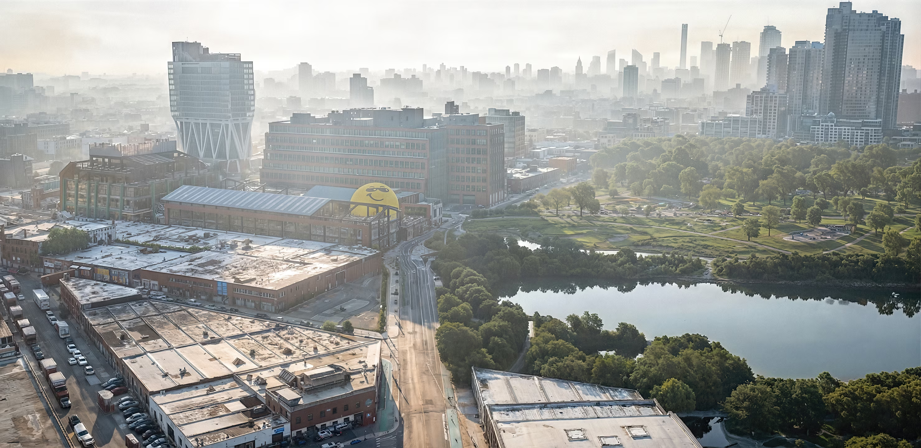
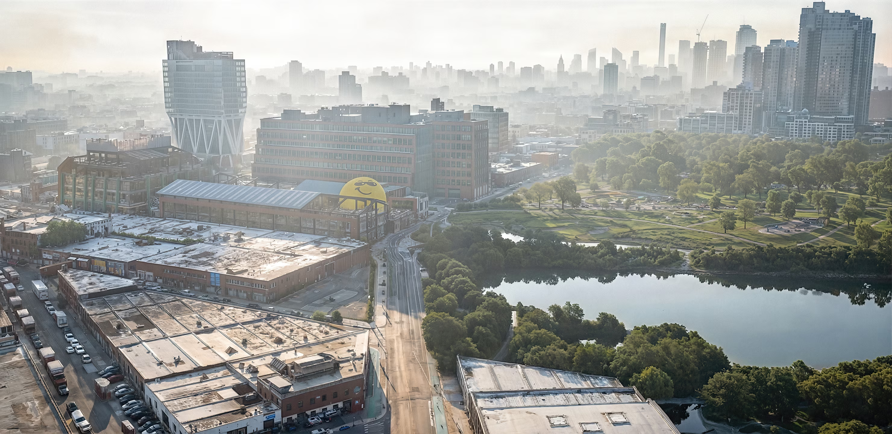
Aerial visualization across North Williamsburg, Brooklyn, created by Arqing without a drone flight.
Some projects are understood best from above. A carefully composed aerial view can reveal a building, its place within the urban context, the skyline beyond it, and the connections that make its location valuable. For architects and real estate developers, that single image can bring clarity to an approval meeting, an investor presentation, or a high-end marketing campaign.
A drone shoot is a great option, and often the right one. It also means finding an operator, scheduling a flight window, confirming site access, and reviewing what comes back: real coordination, on top of everything else a project already has moving. Some teams have the time and the need for that. Arqing exists for the ones who don't, or who need the image sooner than a flight can be arranged.
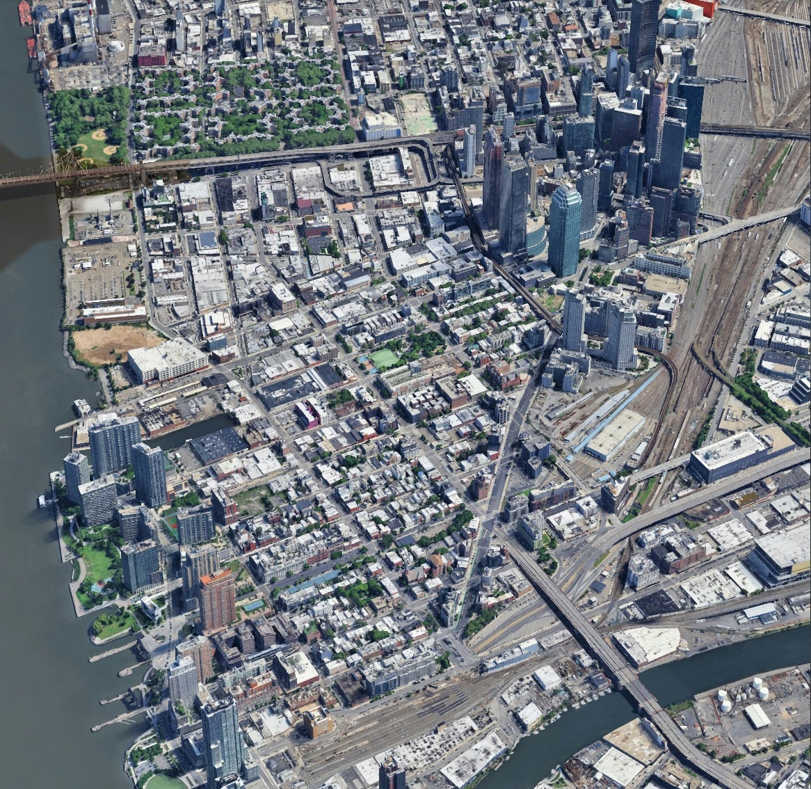 Site reference
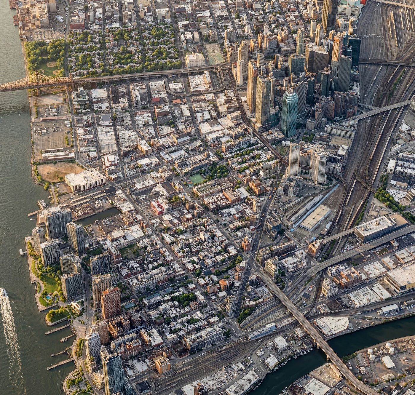 Final aerial view
The Long Island City waterfront and skyline in Queens, carried from 3D reference to finished aerial photography.
A real flight also fixes the result to whatever the sky, the season, and the site looked like that day. Once the images are delivered, the camera position can't change. A higher angle, more separation from a neighbor, or a different time of day means booking another flight, when one is possible at all.
Arqing's process opens a different path. We start from the aerial and mapping reference that already exists for most developed sites today (the same detailed 3D city data now available across major metros) and build the design into it with matching precision; the more detailed that reference is, the sharper the result. From there, the camera, the light, and the stage of completion can be shaped around exactly what the project needs, without booking a new flight every time the composition changes.
Every condition, shaped around the project
When there's no time, or no need, to arrange a drone flight, Arqing can still build a photorealistic aerial view designed to move the project forward. We shape the viewpoint, light, weather, and stage of completion around the design and what the audience needs to see.
Four elements we can control in your aerial view
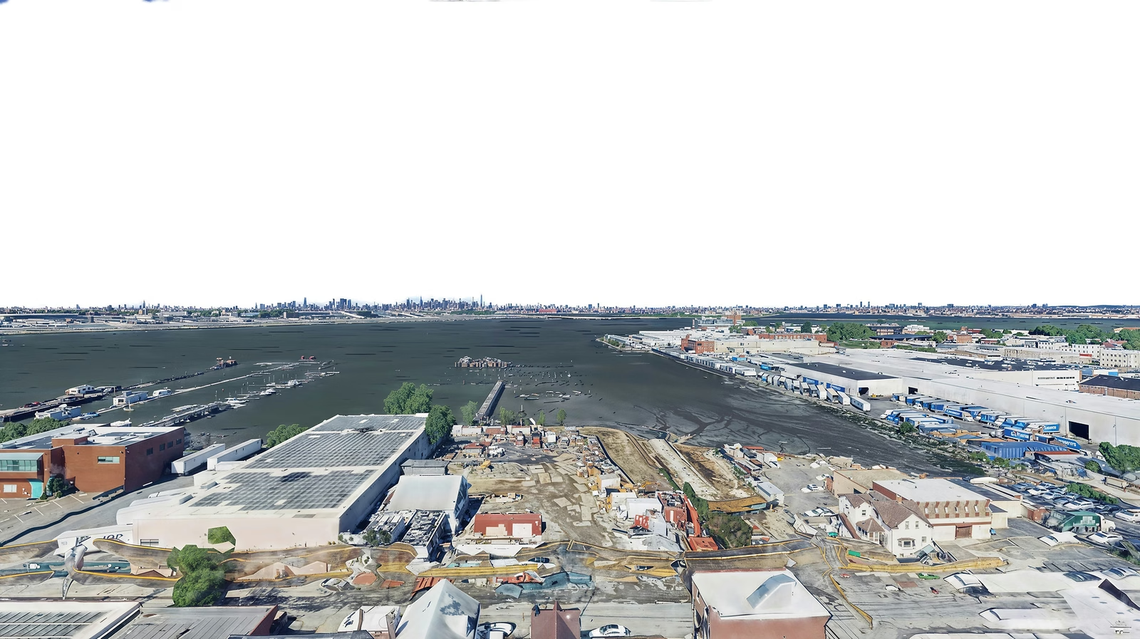 Site reference
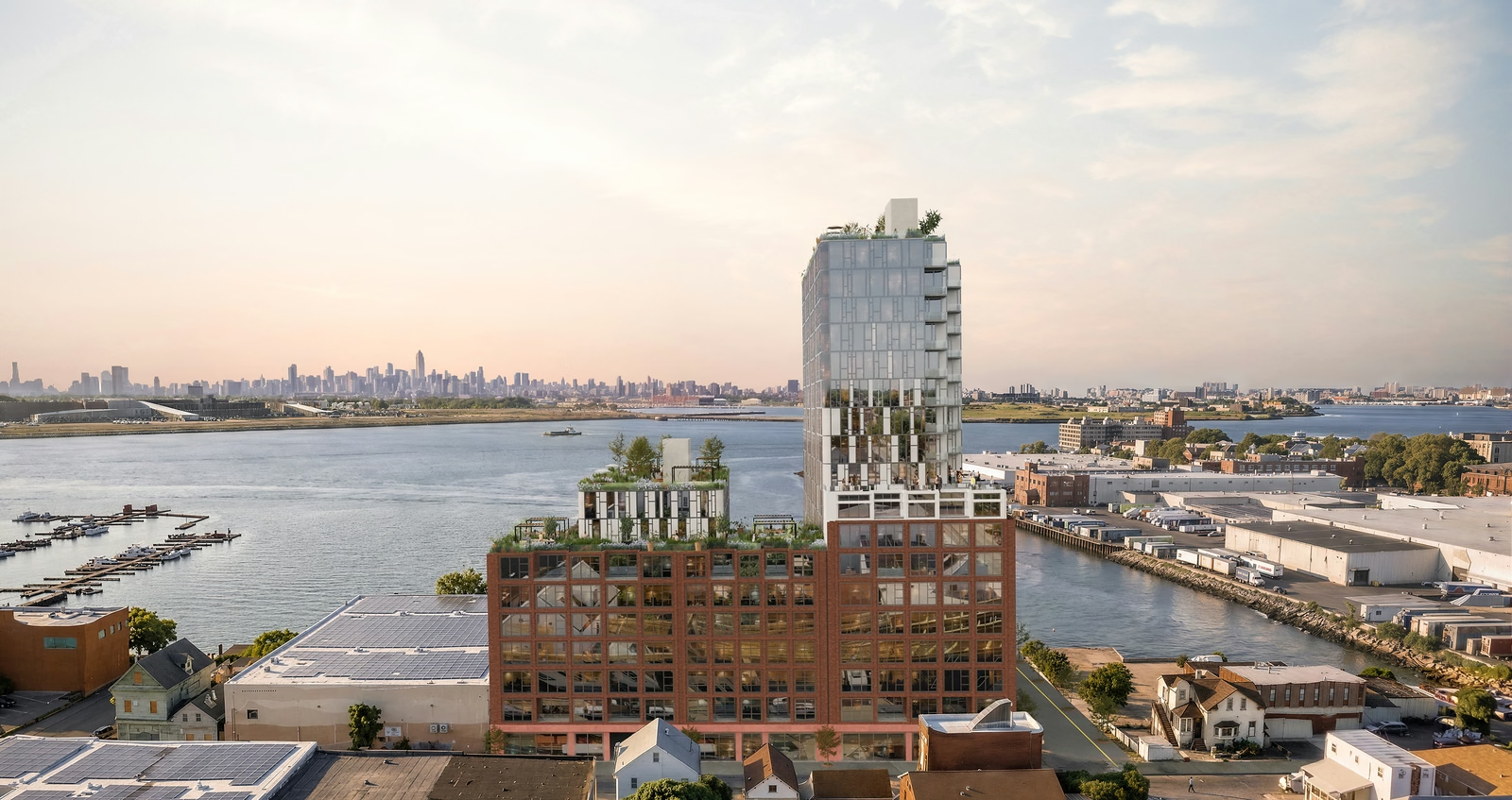 Final aerial view
College Point, Queens: a waterfront development site carried from 3D reference to a dusk aerial built for marketing.
Real data, rendered honestly
A building that hasn't been built yet can't be photographed, so Arqing's job isn't to fake that photograph. It's to build the closest, most convincing version of it that the available project information supports.
We work from the drawings, surveys, site photography, and existing site reference already available for the project, and let that information lead. Design judgment shapes the atmosphere and hierarchy on top of it: an aerial visualization built to read as photography, while staying honest about what it is.
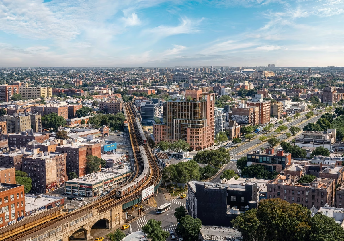
A viewpoint chosen for the architecture
The strongest aerial view is not always the highest or the widest. It is the one that makes the central idea of the project immediately clear. A waterfront development may need the horizon. An urban tower may need its relationship to transit, neighboring buildings, or the New York skyline. We compose the viewpoint around those priorities, protecting the design from distortion and giving your audience the exact context it needs to understand the proposal.
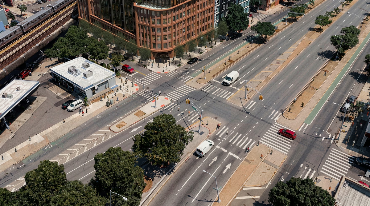
Light and weather become part of the story
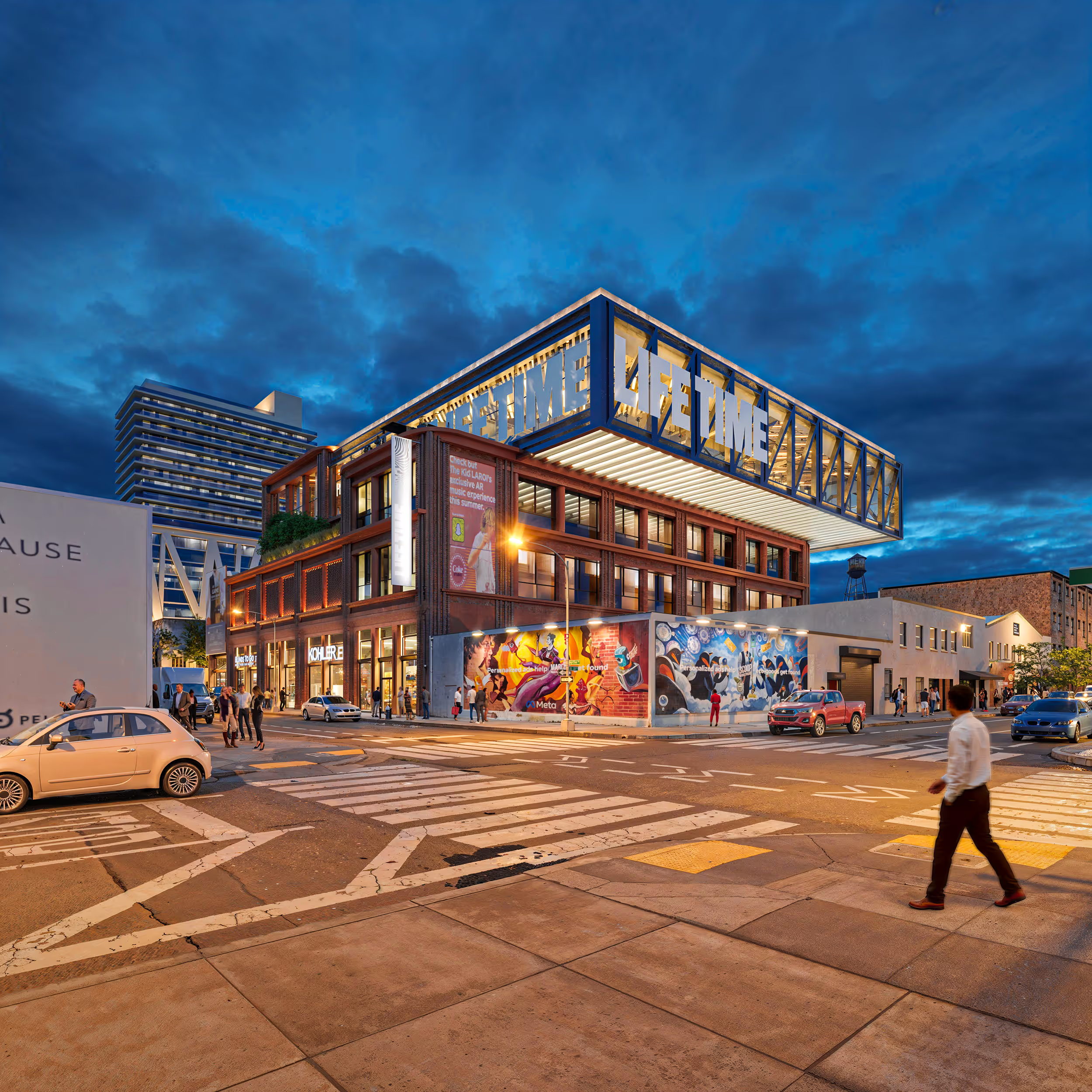
A photograph works with whatever light and weather the day brings. In an aerial visualization, the atmosphere and lighting are chosen intentionally to support the design: crisp daylight to emphasize architectural depth, facade textures, and street-level presence, or dusk to reveal interior warmth and activate the surrounding neighborhood. These choices are never decoration; they help the image carry the right feeling, for the right audience, at the exact moment it matters.
"An aerial image should not simply prove where the building is. It should make clear why it belongs there."Arqing
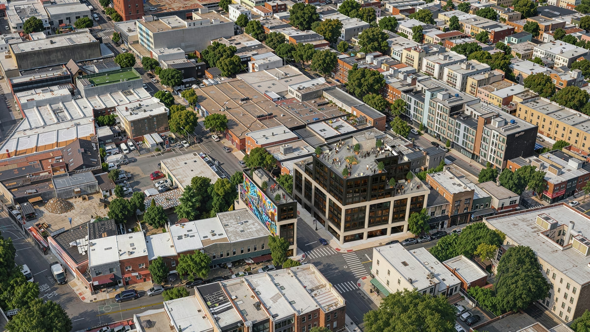
Walk into the approval meeting already ahead
A feasibility study, a community board hearing, an investor call — none of them wait for a construction schedule, and none of them forgive a team that shows up without a clear picture. When there's no time left to commission a flight or build a diagram from scratch, an aerial view Arqing turns around in days can be the difference between explaining a proposal and having to defend it. It doesn't replace the technical analysis; it gives everyone in the room the same accurate picture before positions harden.
One aerial view, several project decisions
For design approvals and investor conversations, the aerial views Arqing builds create a shared point of reference. Architects can protect the original design intent. Developers can explain the value of the location and the project's position within the market. Decision-makers can understand its relationship to neighboring buildings, infrastructure, waterfronts, and the skyline without having to interpret those connections from drawings alone.
For high-end real estate marketing, the aerial view can become the visual anchor of the campaign. It connects architecture with location in a single frame and helps future buyers or tenants understand what the project offers before they can visit it. The image is no longer only a view from above. It becomes a practical asset for communicating value, building confidence, and moving the development toward market.
What disappears from your to-do list
If there's no time, or no need, for a separate aerial production, Arqing manages the visual context, the composition, and the final image, so your team stays focused on design decisions, approvals, leasing, and development.
- Flexible source material. Drawings, surveys, site photographs, and other reliable references can all contribute without making a new drone shoot a prerequisite.
- An independent visual schedule. Flight permissions, airspace conditions, site access, and weather no longer decide when the image is ready — a short deadline and a handful of reliable references are usually enough to start.
- Composition with intent. Altitude, angle, framing, light, and atmosphere are selected to serve the architecture and its audience.
- A view of the completed vision. The project can be presented at its intended stage before construction is finished.
Good reference always strengthens the result: drawings, surveys, site photography, material studies, and anything else that exists helps us protect the design with more precision. None of it is required to begin, though: a missing aerial photograph is never what holds the work up.
This flexibility is especially valuable for visual feasibility studies, dense urban sites, and projects that depend on precise integration into the New York skyline. It gives developers, architects, brokers, and investors a credible view of the proposal while there is still time to evaluate decisions, build support, and prepare the project for market.
Show the project from its strongest point of view
Send the drawings and the address, then tell us what your audience needs to understand. Arqing takes care of the aerial context and creates the image around your project's priorities.